Last year a descendant of the Young family of St. Jacques sent me an old family photograph. The photo was taken during an afternoon excursion across the harbour on the beach in Louis’s Cove. It shows a group of people seated on the ground engaged in a picnic. The picnic took place sometime around 1930. It is quite an interesting image to explore. The people, the picnic site, the way people were dressed, who they were, and many other things are fascinating. One of the most interesting things is the background for it shows the northern side of the harbour; that is the portion of the community that runs from the Barachoix Point to that area where the slipway is now located on the Lower Road. As you might expect when enlarged the image is somewhat blurry, however, we can see the shapes of buildings and the general lay of the land. Below is that section of the photograph.
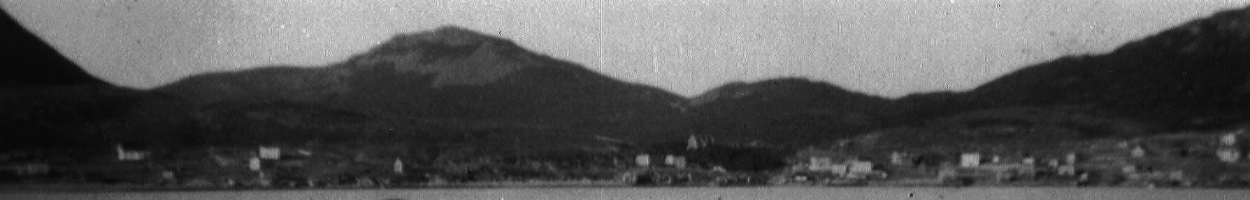
Northern side of St. Jacques c.1930
On the left of this image we see the vague shape of a house near the bottom. That house was once lived in by C. Pope and is now lived in by the family of G/J Evans. To the right and slightly higher in the picture is the old St. Micheal’s and All Angels Anglican School. Almost directly below that is a house owned by a member of the Noseworthy family; now owned by R/K Dominix. Next we can see another house once owned by another member of the Noseworthy family, later by T/ M Stoodley and now by C/S Dodge. Slightly above this house is another one built by J. Johnson from St. Bernards who married N. Noseworthy and is now owned by the family of T/B Lawrence. Look a little further along and your eyes will observe the sharp peak of a house below the road that seems to be perched on the edge of the bank. This house was also owned by the Noseworthy family but is no longer standing. Take some time to wander along the roadway over to Pittman’s Brook and beyond. Try out your historic knowledge of the community and find who lived in the various houses that are visible in the photograph.
Below is a photograph which I created about five years ago that includes that same section of the community. We can see Big Hill, Bungay’s Hill and Winterhouse Hill in the background as well as a bit more space than in the older image. This picture was taken from a slightly different location with a wider angle lens thus more of the harbour is visible. Take some time to compare both photographs and see how much change has occurred in almost one hundred years.
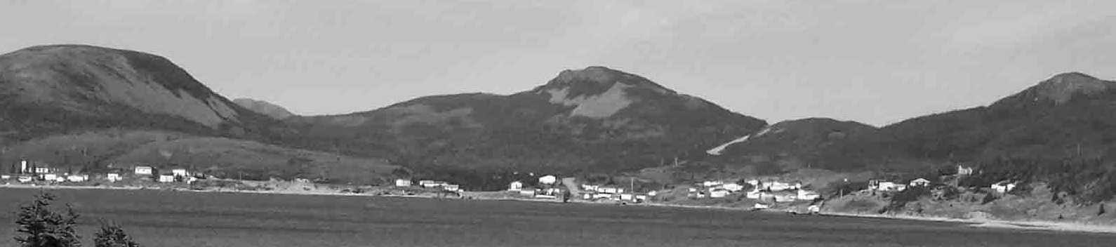
Northern side of St. Jacques, 2009
If you have old photographs of St. Jacques which you’d like to share, please send it along to me at stjacquesblog@gmail.com.

Leave a comment